- Author: Richard B Standiford
General Overview

Audience
The conference is intended for anyone involved in research, education, management, and conservation of California’s oak woodlands. This includes foresters, range managers, tribes, arborists, landowners, community groups, land trusts and policy makers.
Call for Papers
A general call for papers will be issued February 15, 2014. Check out the conference website for the general call when it is available. Sessions will include:
- Range management
- Oak Ecology
- Wildlife and Biodiversity
- Silviculture
- Regeneration & Restoration
- Urban forestry & Arboriculture
- Genetics
- Soils & Physical Processes
- Economics, Policy, Social Sci.
- Cultural Values
- Insects & Disease
- Fire & Disturbance
- Monitoring and Inventory
- Climate & Atmosphere
- Carbon Storage and Cycles
- Products & Utilization
Sponsors
- University of California Oak Woodland Conservation Program
- University of California, Berkeley, Center for Forestry
- University of California Division of Agriculture and Natural Resources
- USDA Forest Service Pacific Southwest Research Station
- Author: Richard B Standiford
- Author: Kathryn Purcell
Overview:
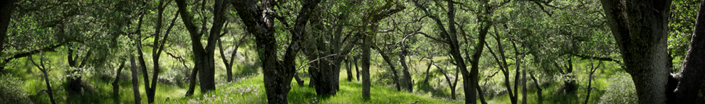
Beginning in 1979, there have been a series of symposia held every 5 to 7 years addressing the state of our knowledge about science, policy and management factors affecting California's oak resource. This program, held November 3-6, 2014 in Visalia, CA, represents the 7th symposium in the series. California's oak woodlands cover 10 percent of the state, and in addition, are a key ecological component of conifer forests. Oak woodlands are the most biologically diverse broad habitat in the state, making conservation of their ecosystem values an important policy and management priority. The meeting location in the San Joaquin Valley was conveniently situated for both northern and southern California oak scientists, managers, policy makers and interest groups.
The proceedings of the 7th symposium represents the most current, and comprehensive overview of issues facing oak woodlands, and can be downloaded at: http://www.fs.fed.us/psw/publications/documents/psw_gtr251/
The proceedings have 56 papers in a broad array of subject areas, including: wildlife and oaks; oak ecosystem services; oak restoration; oak conservation, management and utilization; and the gold-spotted oak borer and sudden oak death. The full citation for this is:
Standiford, Richard B.; Purcell, Kathryn L., tech. cords. 2015. Proceedings of the seventh California oak symposium: managing oak woodlands in a dynamic world. Gen. Tech. Rep. PSW-GTR-251. Berkeley, CA: U.S. Department of Agriculture, Forest Service, Pacific Southwest Research Station. 579 p.
Sponsors:
- USDA Forest Service Pacific Southwest Research Station
- University of California Oak Woodland Conservation Program
- University of California, Berkeley, Center for Forestry
- University of California Division of Agriculture and Natural Resources
Previous Oak Symposia:
- June 26-28, 1979; Claremont, CA; Proceedings of the symposium on the ecology, management, and utilization of California oaks - USDA Forest Service PSW-GTR 44
- November 12-14, 1986; San Luis Obispo, CA; Proceedings of the Symposium on Multiple-Use Management of California's Hardwood Resources - USDA Forest Service PSW-GTR 100
- October 31 - November 2, 1990; Davis, CA; Proceedings of the symposium on oak woodlands and hardwood rangeland management - USDA Forest Service PSW-GTR 126
- March 19-22 1996; San Luis Obispo, CA; Proceedings of a symposium on oak woodlands: ecology, management, and urban interface issues - USDA Forest Service PSW-GTR 160
- October 22-25, 2001; San Diego, CA; Proceedings of the fifth symposium on oak woodlands: oaks in California's changing landscape - USDA Forest Service PSW-GTR 184
- October 9-12, 2006; Rohnert Park, CA; Proceedings of the sixth California oak symposium: today's challenges, tomorrow's opportunities - USDA Forest Service PSW-GTR 217
- Author: Gregory A Giusti
- Editor: Richard B Standiford

To water or not to water….an oak. That's the question. If only Shakespeare could answer our questions as eloquently as in his plays. In a state where the motto has become “brown is the new green” as people allow irrigated lawns to die, more and more folks are concerned over the potential loss of oak trees in their garden. These trees not only provide shade and aesthetic appeal they also can provide tremendous real value to a piece of property. In some cases, fixture oaks have a sentimental story…a place where a wedding occurred; or a child once had a swing hanging from its branches; or even memories of planting an acorn with a child and watching the sprout grow into a magnificent tree.
The extraordinary drought has caused many to reconsider the mantra of “don't water oaks” as excessive water can lead to the development and spread of root pathogens that can weaken or even kill oak trees. But if we consider what is being asked of trees in this drought it gives us pause to rethink our approach to providing water to insure that these trees will survive. In some parts of the state oaks are being deprived of water for as long as nine months, in some cases even longer, creating extreme water stress in trees. Stress provides an opportunity for other pests and diseases to expand and further stress the oaks. Ultimately, trees will succumb to the multiple stress impacts brought on by the drought.
Though against all past conventional wisdom we are now suggesting to those concerned and asking about their “fixture” oaks that a once-a-month irrigation be provided during the dry months in an attempt to sustain the trees until the onset of winter rains. Obviously, this can only be considered if one might have water to spare or is not under severe mandatory water rationing.
The once-a-month irrigation should be directed and concentrated below the drip-line of the tree. This is the area directly below the branches. Sufficient water should be provided to insure percolation down to 12-18” below the soil line.
It's important to allow the soil to dry out completely between irrigations to reduce the risk of root diseases. Moderation is the key to this strategy and should only be considered a stop-gap measure until the drought conditions have abated.
